
Surveying
Drone surveying services provide fast, accurate, and cost-effective mapping solutions for industries such as construction, mining, agriculture, and real estate. Equipped with high-resolution cameras, LiDAR, and GPS technology, drones capture detailed aerial data that can be transformed into 2D maps, 3D models, and digital elevation models (DEM). This allows for precise measurements of land, stockpiles, infrastructure, and terrain—without the need for traditional ground-based surveying methods. Drone surveys save time, reduce costs, improve safety, and deliver reliable data for planning, monitoring, and decision-making. Perfect for large or hard-to-reach areas, drone surveying is revolutionizing how professionals approach land mapping and site analysis.
Enhance accuracy and efficiency in land surveying, mapping, and inspections with our Surveying Drone Services. Our cutting-edge drones capture high-resolution aerial data, reducing time, costs, and human risk in surveying operations.
Our Services Include:
Topographic Mapping & 3D Modeling:
Generate detailed topographic maps, 3D terrain models, and digital elevation models (DEMs) for precise project planning.
Land & Property Surveys:
Fast and accurate aerial surveys for residential, commercial, and industrial properties, ensuring compliance with legal and regulatory standards.
Construction & Infrastructure Monitoring:
Track construction progress, inspect roads, bridges, pipelines, and industrial sites with high-resolution imaging.
Photogrammetry & GIS Integration:
Capture georeferenced imagery for mapping, analysis, and integration into Geographic Information Systems (GIS).
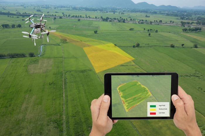
Agricultural & Environmental Surveys:
Monitor land use, forest cover, water bodies, and environmental changes for planning and research purposes.
Why Choose Us?
Experienced drone operators with expertise in surveying and mapping
Fast deployment and reduced survey times compared to traditional methods
Accurate, reliable, and high-resolution data collection
Cost-effective solutions for both small-scale and large-scale projects
Leverage the power of drones to collect precise data, improve project efficiency, and reduce operational costs. Trust our surveying drone services for accurate, actionable insights every time.


