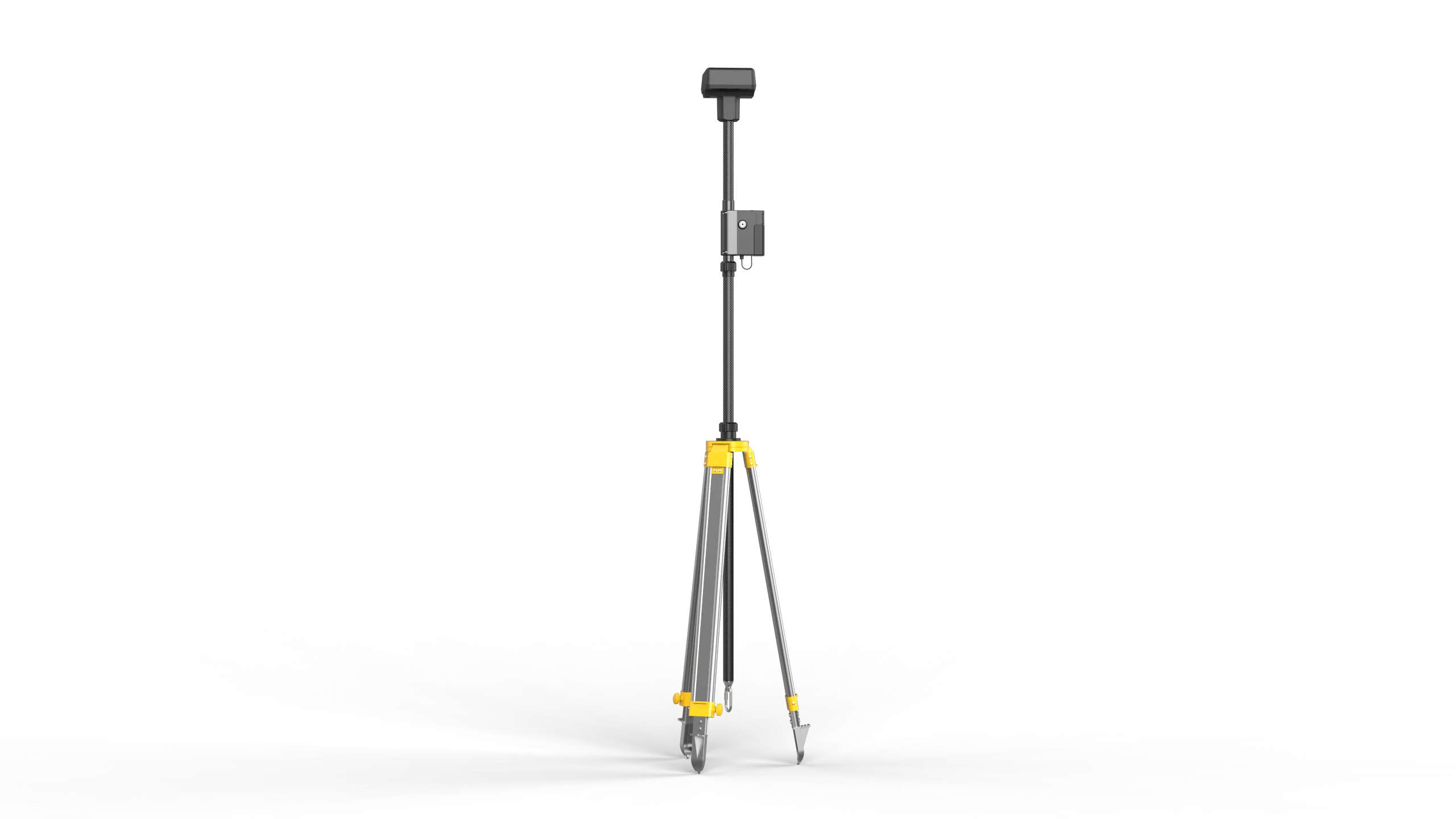
D-RTK 2 Base Station – For DJI Enterprise Series
The DJI D-RTK 2 is a top-tier GNSS (Global Navigation Satellite System) mobile station designed specifically for enterprise drone operations, offering centimeter-level accuracy and robust correction data for RTK-enabled UAVs.
It serves as a portable base station that streams real-time differential corrections to a drone and controller, significantly improving positioning precision — which is essential for mapping, surveying, inspection, agriculture, and industrial drone missions.
⚙️ Key Features
| Feature | Description |
|---|---|
| Centimeter-Level RTK Positioning | Improves relative positioning accuracy to roughly 1 cm + 1 ppm horizontally and 2 cm + 1 ppm vertically. |
| Multi-Constellation GNSS Support | Simultaneously receives GPS (L1/L2/L5), GLONASS, Galileo, and BeiDou signals. |
| Versatile Communication Links | Supports multiple transmission modes: OcuSync, Wi-Fi, LAN, and 4G. |
| Weather-Proof Build | IP65-rated, rugged carbon-fiber shell — designed to perform in harsh conditions. |
| Portable Power Options | Internal Lithium-ion battery (WB37: ~2h runtime) and support for external high-capacity batteries like MG-12000P (~50h). |
| Intelligent IMU & Tilt Monitoring | Built-in accelerometer and tilt sensors ensure stability. If the unit is moved or tilted, it automatically warns the operator and may pause RTK corrections. |
| Wide Temp Operating Range | Operates from –20°C to +55°C, suitable for diverse climates. |
🌐 Typical Applications
Professional Surveying & Mapping (e.g. RTK-enabled drones like Matrice 300 RTK, Agras, Phantom 4 RTK, P4 Multispectral)
Agricultural Drone Missions requiring centimeter-level accuracy for crop health data
Infrastructure Inspection & 3D Modelling where precise geolocation is critical
Construction & Industrial Monitoring in GNSS-challenged or long-duration survey tasks
Crowd Control & Public Safety when multi-drone operations are coordinated using a single base station
Popular Item
Related Products
.webp)