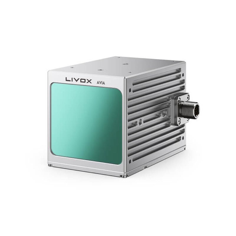
Avia LiDAR Sensor – Livox
The Avia LiDAR Sensor by Livox is a high-performance, lightweight, and cost-effective LiDAR solution designed for mapping, surveying, autonomous navigation, and environmental monitoring. Known for its compact design and advanced scanning capabilities, the Avia delivers high-density, accurate 3D point clouds even in complex environments.
Long Detection Range – Up to 460 meters for high-altitude and wide-area mapping.
High Accuracy – Provides precise 3D point clouds with centimeter-level accuracy.
Multi-Echo Technology – Detects multiple returns for enhanced data capture in vegetation and dense areas.
Compact & Lightweight – Weighs only ~498g, ideal for UAV integration.
Wide Field of View (FoV) – 70.4° (horizontal) × 77.2° (vertical) for maximum coverage.
With its multi-echo detection and long-range scanning, it ensures reliable performance in diverse applications such as aerial surveys, mobile mapping, forestry, and infrastructure inspection. The Avia is widely used with UAVs, robotics, and mobile platforms, offering professional-grade LiDAR technology at a fraction of the cost of traditional systems.
🌟 Key Features
Long Detection Range – Up to 460 meters for high-altitude and wide-area mapping.
High Accuracy – Provides precise 3D point clouds with centimeter-level accuracy.
Multi-Echo Technology – Detects multiple returns for enhanced data capture in vegetation and dense areas.
Compact & Lightweight – Weighs only ~498g, ideal for UAV integration.
Wide Field of View (FoV) – 70.4° (horizontal) × 77.2° (vertical) for maximum coverage.
High Point Rate – Up to 240,000 points per second for rich detail and smooth mapping results.
Reliability – Advanced anti-interference design for stable outdoor performance.
🔧 Technical Specifications (General)
Detection Range: Up to 460m (reflectivity dependent)
Point Rate: 240,000 pts/s
Accuracy: ±2 cm
FoV: H: 70.4° × V: 77.2°
Weight: ~498g
Operating Temperature: -20°C to 65°C
Interface: Ethernet, standard SDK support
🌱 Applications
📍 UAV Aerial Mapping – Large-scale topographic surveys with high accuracy.
🌳 Forestry & Agriculture – Vegetation analysis and canopy measurement with multi-echo returns.
🏗 Infrastructure & Power Line Inspection – Safe, precise mapping of critical assets.
🚗 Autonomous Navigation & Robotics – Real-time 3D environment perception.
🌊 Coastal & Environmental Monitoring – Accurate terrain and ecosystem mapping.
👉 The Livox Avia LiDAR Sensor is an affordable, professional-grade solution that delivers exceptional performance, range, and accuracy for UAVs, robotics, and mobile platforms—empowering industries with cutting-edge 3D data capture.
Popular Item
Related Products
.webp)