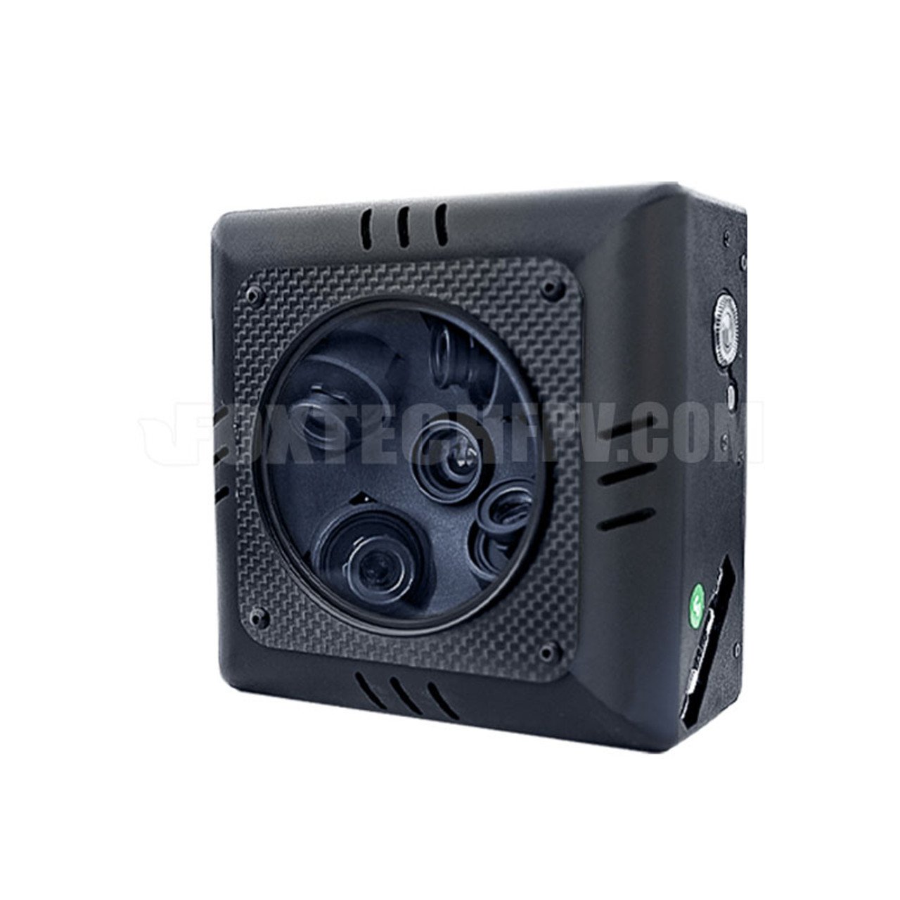

Foxtech 3DM V4 Oblique Camera
Equipped with five APS-C CMOS lenses: one nadir (25 mm) and four oblique (35 mm) at a 45° angle, this setup captures terrain from multiple perspectives for rich, detailed 3D reconstruction.
Each lens offers 24.3 MP, combining to a total of 120 MP for ultra-high-resolution outputs.
Lightweight & Drone-Friendly
Weighing only 673 g and sizing 126 × 126 × 89 mm, it’s designed for seamless integration with drones and VTOLs such as the NAGA series, RHEA 160, and AYK VTOL models.
Fan-cooled design ensures thermal stability during extended flights.
Storage & Workflow Efficiency
Features five external SD card slots with combined storage up to 320 GB, easing data management and quick transfers.
Achieves mapping precision up to 5 cm when used with RTK and ground control points. Supports pre-processing with LSV or Photomesh before exporting to standard software like Pix4D or ContextCapture.
Technical Specifications
| Spec | Details |
|---|---|
| Number of Lenses | 5 (1× 25 mm, 4× 35 mm oblique) |
| Resolution | 5 × 24.3 MP = 120 MP total |
| Weight | 673 g |
| Dimensions | 126 × 126 × 89 mm |
| Cooling | Active fan-based cooling |
| Storage | 5 × SD card slots (up to 320 GB total) |
| Precision | Up to 5 cm with RTK + GCP |
| Compatible Platforms | NAGA quadcopter, AYK VTOL, RHEA hexacopter, etc. |
| Flight Envelopes | Altitude: 50–300 m; Speed: up to 23 m/s |
| Power Supply | 8–28 V input |
| Operating Temp | –10 °C to 40 °C |
| Data Speed | 45 MB/s |
| Exposure Interval | Minimum 1.2 s |
Why Choose the 3DM V4?
High-Precision Mapping: Generate orthophotos, DEMs, and 3D models with centimeter-level accuracy—ideal for urban planning, cultural site documentation, and land development
Drone-Compatible & Efficient: Lightweight design combined with generous storage and fast data export simplifies mission planning and data collection.
Scalable Integration: Easily integrates with various UAV platforms, making it a flexible choice for diverse aerial surveying applications
Popular Item
Related Products
.webp)