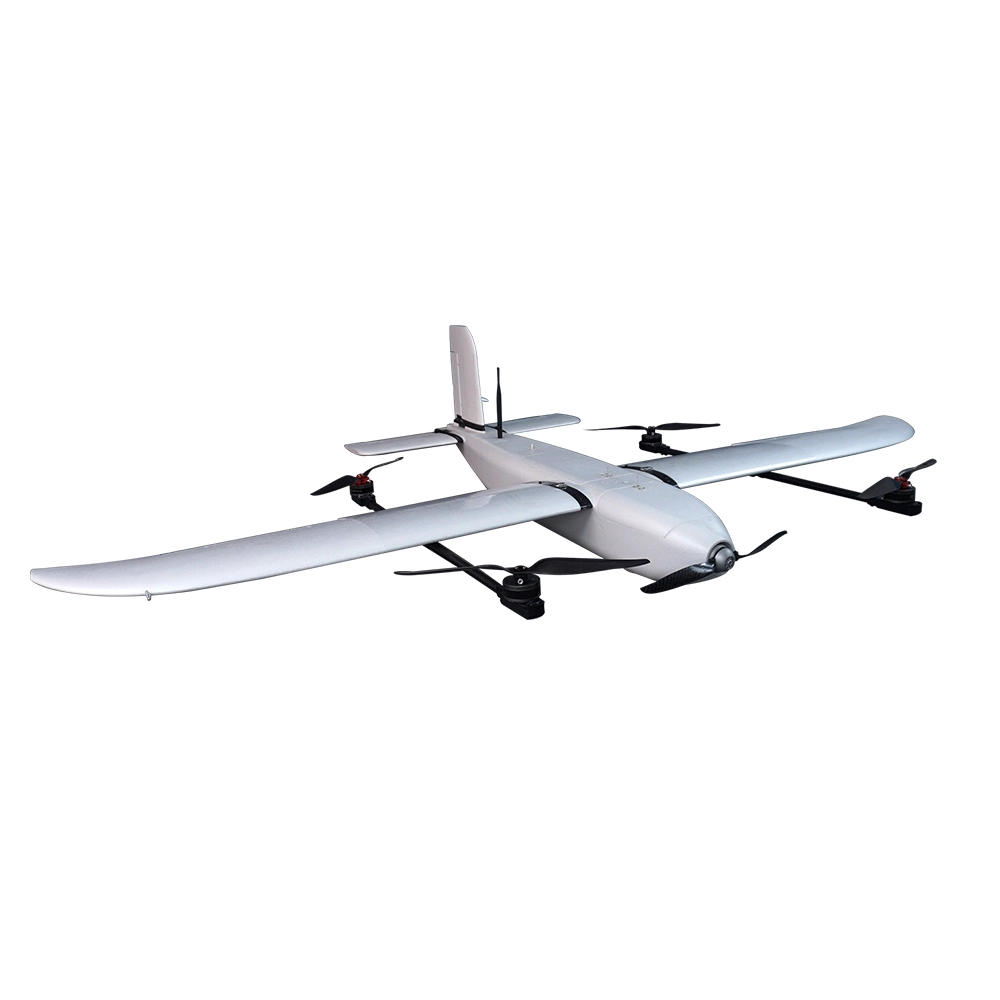
Indrones Sigma Drone 25 With RGB And PPK
The Indrones Sigma Drone 25 is a high-precision, lightweight UAV tailored for surveying, mapping, agriculture, and environmental monitoring in challenging terrains. Its RTK/PPK module elevates accuracy to centimeter-level standards.
Compact & Survey-Grade Build
Weighs under 3 kg, with a sleek carbon fiber frame—optimized for portability and quick deployment.
Impressive Flight Performance
Up to 50 minutes of endurance, capable of reaching altitudes up to 4,500 m, and offering a 4 km line-of-sight (LOS) operational range.
RTK/PPK Survey-Grade Accuracy
Equipped with Real-Time Kinematic (RTK) and Post-Processed Kinematic (PPK) systems for centimeter-level geotagging and mapping precision.
The Indrones Sigma Drone 25 is a high-precision, lightweight UAV tailored for surveying, mapping, agriculture, and environmental monitoring in challenging terrains. Its RTK/PPK module elevates accuracy to centimeter-level standards.
Core Specifications & Highlights
Compact & Survey-Grade Build
Weighs under 3 kg, with a sleek carbon fiber frame—optimized for portability and quick deployment.
Impressive Flight Performance
Up to 50 minutes of endurance, capable of reaching altitudes up to 4,500 m, and offering a 4 km line-of-sight (LOS) operational range.
RTK/PPK Survey-Grade Accuracy
Equipped with Real-Time Kinematic (RTK) and Post-Processed Kinematic (PPK) systems for centimeter-level geotagging and mapping precision.
High-Quality Imaging
Comes with a 20 MP (RGB) camera, delivering sharp, georeferenced imagery ideal for mapping, photogrammetry, and inspections.
Reliable & Smart Operation
Features toolless assembly for fast deployment, encrypted communication, failsafe mechanisms, and cloud connectivity for predictive maintenance.
Applications & Use Cases
Land Surveying & Mapping – Ideal for accurate orthophotography, DEM generation, and topographic modeling.
Agriculture & Forestry – Leverage RGB data and geotagged accuracy for crop health monitoring and forest analysis.
Infrastructure & Environmental Surveys – Track minute changes and terrain features across construction, mining, and environmental projects.
Quick Reference Table
| Feature | Specification |
|---|---|
| Weight | < 3 kg |
| Flight Time | Up to 50 minutes |
| Service Ceiling | Up to 4,500 m |
| Communication Range | Approx. 4 km LOS |
| Imaging | 20 MP RGB |
| Positioning | RTK/PPK, Survey-grade accuracy |
| Deployment | Tool-less assembly, portable in a single backpack |
| Robust Features | Encrypted comms, fail-safe, predictive maintenance |
Popular Item
Related Products
.webp)