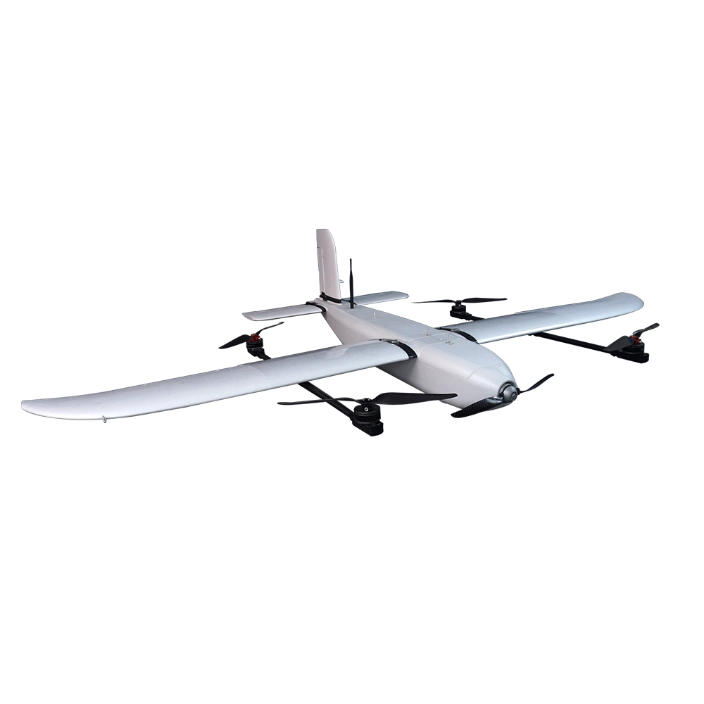

Indrones Sigma Drone 25 With RGB And Without PPK
The Indrones Sigma Drone 25 with RGB and without PPK is a lightweight, survey-grade UAV designed for high-precision mapping and aerial imaging. Ideal for applications in agriculture, construction, and environmental monitoring, this drone offers a balance between performance and affordability.
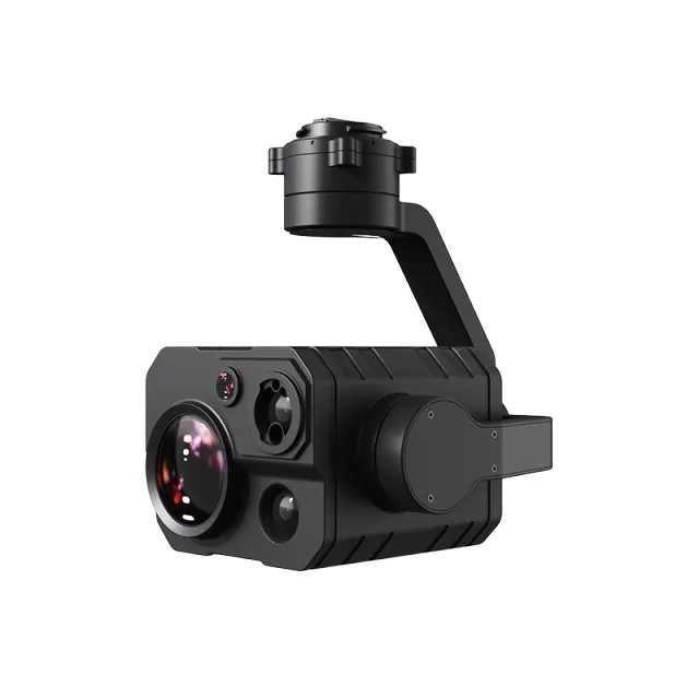
High-Resolution RGB Imaging: Equipped with a 20 MP RGB camera, it captures detailed aerial imagery suitable for orthomosaic mapping and photogrammetry.
Survey-Grade Accuracy: While lacking RTK/PPK modules, it still provides reliable georeferencing for various surveying tasks.
Lightweight Design: Weighing under 3 kg, it ensures easy portability and quick deployment, making it suitable for field operations.
Extended Flight Time: Offers up to 50 minutes of flight time, allowing for efficient data collection over large areas.
The Indrones Sigma Drone 25 with RGB and without PPK is a lightweight, survey-grade UAV designed for high-precision mapping and aerial imaging. Ideal for applications in agriculture, construction, and environmental monitoring, this drone offers a balance between performance and affordability.
📸 Key Features
High-Resolution RGB Imaging: Equipped with a 20 MP RGB camera, it captures detailed aerial imagery suitable for orthomosaic mapping and photogrammetry.
Survey-Grade Accuracy: While lacking RTK/PPK modules, it still provides reliable georeferencing for various surveying tasks.
Lightweight Design: Weighing under 3 kg, it ensures easy portability and quick deployment, making it suitable for field operations.
Extended Flight Time: Offers up to 50 minutes of flight time, allowing for efficient data collection over large areas.
Robust Build: Constructed with a carbon fiber frame, it withstands challenging environmental conditions.
📊 Technical Specifications
| Specification | Details |
|---|---|
| Operating Altitude | Up to 400 ft AGL |
| Cruise Speed | 12 m/s |
| Maximum Take-off Weight (MTOW) | < 3000 g |
| Battery Capacity | 12600 mAh |
| Recommended Payload | 400 g |
| Flight Time | Up to 50 minutes |
| Service Ceiling | Up to 4500 m |
| Communication Range | Up to 4000 m |
🛠️ Applications
Agricultural Monitoring: Assess crop health and monitor field conditions.
Construction Surveying: Conduct site surveys and monitor progress.
Environmental Studies: Collect data for environmental impact assessments.
Infrastructure Inspection: Inspect roads, bridges, and other infrastructure.
Popular Item
Related Products
.webp)